


Extreme Weather Is Now a Procurement Risk: How to Build Climate Resilience into Your Strategy
- Extreme weather now triggers a billion-dollar supply chain event at short intervals, making it a procurement priority, not just a sustainability topic.
- Standard resilience playbooks designed for single-node failures are not adequate for climate-driven disruptions.
- Embedding climate risk data into supplier selection, contract design, and logistics planning is exactly what separates prepared organizations from reactive ones.
July 24, 2026 | Procurement Strategy 4 minutes read
In the United States, a billion-dollar weather and climate disaster now occurs, on average, about every three weeks. In the 1980s, the interval was roughly once every four months, according to the Fifth National Climate Assessment. That is not a gradual drift, rather a structural change in the operating environment that procurement has yet to fully absorb.
Extreme weather trails geopolitical tensions when it comes to threat to business operations. Most business leaders agree their supply chains are already affected by climate events. The disruption is not coming. It is here.
The GEP Global Supply Chain Volatility Index
Get the latest intelligence on global supply chain volatility and anticipate risks before they impact your business
How Does Extreme Weather Become a Procurement Problem?
The challenge for procurement is that most resilience frameworks were built for a different category of disruption. Factory fires, port strikes, single-supplier failures — these are bounded events. They are bad, but they affect a specific node in the supply chain for a defined period, and the response playbook (safety stock, backup suppliers, expediting) is well understood.
Climate disruptions work differently. A prolonged drought doesn't close one port, it reduces capacity on entire waterways. Low water levels in the Panama Canal in 2023, for example, reduced transit volumes for months and affected 5% of world trade by volume, according to Reuters. Then again, cyclones in South and Southeast Asia caused billions of dollars in damages to countries such as Indonesia, Malaysia, Thailand, Vietnam and Sri Lanka in late 2025. The damage, however, was more than just economic.
When the disruption is geographic and persistent rather than localized and acute, the standard playbook doesn't hold.
How Can Enterprises Practically Build Climate Resilience into Their Procurement Strategy?
Procurement teams can no longer afford to treat climate risk as an external variable. Building resilience requires integrating climate considerations into core procurement decisions — from supplier selection and network design to contracts and logistics planning.
Map Supplier Concentration Against Physical Climate Risk
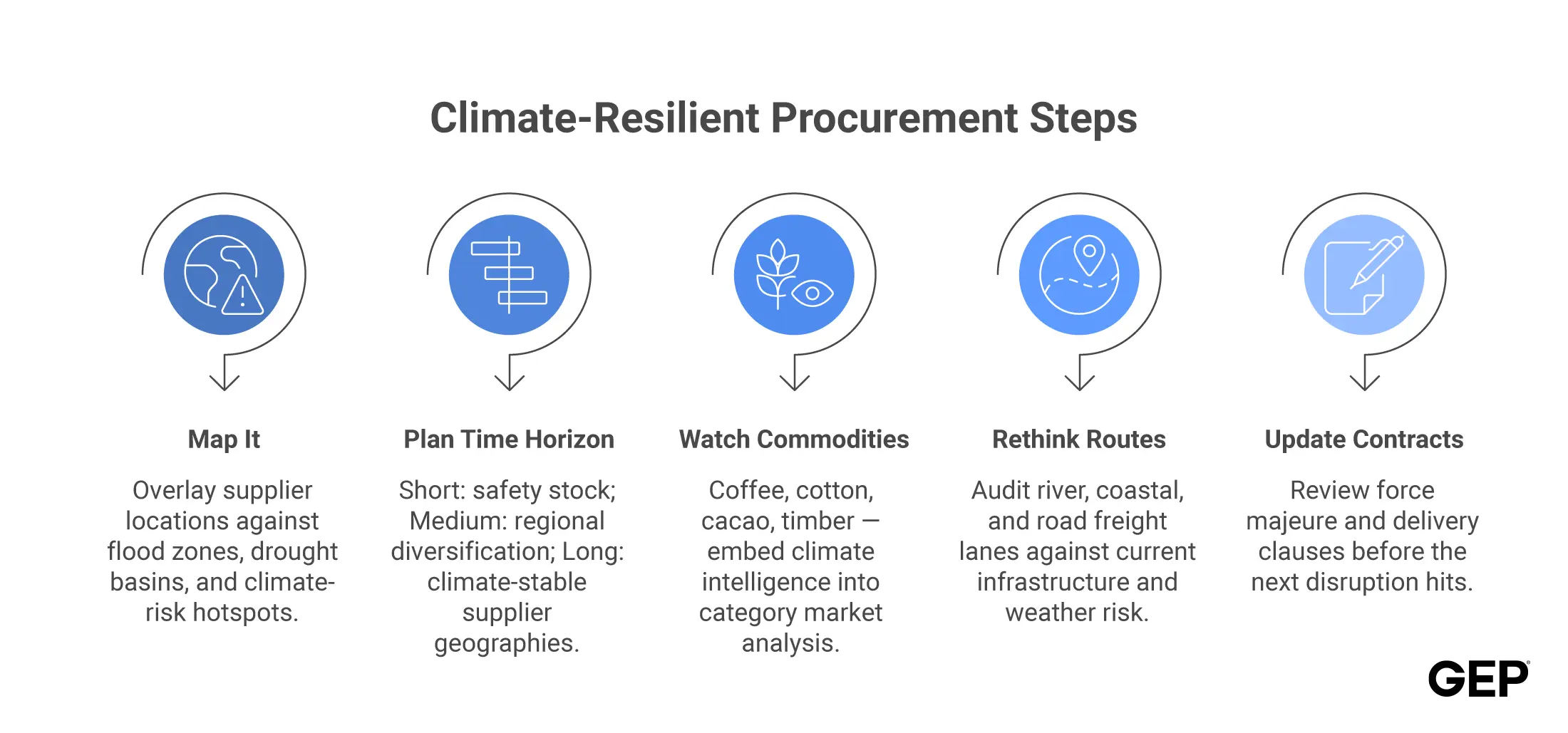
The first step is overlaying your supplier network onto climate risk data. Are critical suppliers clustered in coastal flood zones, drought-prone river basins, or regions with aging infrastructure? This is not a sustainability audit; it’s a sourcing risk assessment. Tools from weather and supply chain risk analytics firms now allow procurement teams to score suppliers against modeled climate scenarios with reasonable accuracy.
Categorize Risk by Time Horizon
Climate risk plays out on short (seasonal weather patterns), medium (infrastructure degradation), and long (structural regional shifts in water, agriculture, and logistics) timescales. Procurement strategy needs to address all three, which means short-term safety stock policies, medium-term supplier diversification by region, and long-term consideration of climate stability when selecting new supplier geographies.
Agriculture and Commodities Need Dedicated Attention
The agriculture market offers a vivid lesson. With weather disruptions affecting the sowing of grains globally, the prices rose exponentially as devastating weather reduced production while demand held. Similar dynamics play out regularly in coffee, cotton, and other commodity categories where weather determines supply. Procurement teams in these categories need forward-looking climate intelligence embedded in their market analysis. And not just historical price data.
Redesign Logistics Assumptions
Water levels, seasonal conditions, and infrastructure resilience all affect transportation routes and lead times in ways that are increasingly difficult to forecast with historical models alone. Route optimization strategies that assume standard seasonal patterns may need fundamental revision, especially for river and coastal freight.
Build Response Protocols into Contracts
Climate-related disruptions can create ambiguity around force majeure clauses, delivery obligations, and supplier performance standards. Procurement teams that review and update these provisions proactively are better positioned when disruptions occur — both to enforce contracts appropriately and to protect their own obligations to downstream customers.
Looking for Ways to Protect Your Business from Disruptions
GEP can help you navigate the unpredictability and protect your margins with confidence
Conclusion: The Readiness Gap is Wide
Industry surveys confirm the gap. Majority of supply chain leaders expect disruptions to intensify over the couple of years, but not all are prepared. The organizations closing that gap are doing so by treating climate as an input to sourcing strategy, informing supplier selection, contract design, and network architecture, rather than a post-facto risk to manage after disruptions land.



FAQs
Extreme weather disrupts supply chains across multiple dimensions simultaneously: transportation routes become inaccessible (flooded roads, warped rail, reduced waterway capacity), production facilities shut down or reduce output, raw material availability drops due to agricultural damage, and logistics lead times extend unpredictably. Because climate events are often regional and prolonged, they can affect multiple suppliers and transport modes at once — which is why standard single-node resilience strategies are insufficient.
Climate risk mapping involves overlaying a company's supplier network and logistics routes against geospatial climate risk data, such as flood zones, drought indices, storm frequency, and sea-level projections, to identify concentration risks and vulnerability hotspots. It is used in procurement to inform supplier diversification strategies, identify which categories need safety stock buffers, and prioritize which supplier relationships need continuity planning investment.
In the near term, the highest-impact actions are: auditing supplier geographic concentration against current climate risk data; reviewing and updating force majeure and delivery obligation clauses in key supplier contracts; building safety stock policies for categories sourced from high-risk regions; and establishing alternative routing options for logistics lanes vulnerable to seasonal weather disruption. These steps don't require a full strategy overhaul, and can be integrated into existing category review cycles.